This work was part of an international research project led by the Geological Survey of Denmark and Greenland, investigating the Paleoarchean (3.8 Ga) Isua Greenstone Belt in southern West Greenland.
The field season in Greenland lasts about six weeks at best, limited by weather that makes field work impossible as late as July and as early as mid-August. The project was multi-year, and the summer I participated I teamed with Simon Hanmer of the Canadian Geological Survey to map footwall gneisses beneath the western part of the Isua complex. We interpret the gneisses as a 3.64 Ga stack of mylonitic crystalline thrust-nappes, the oldest example known on Earth.
To read the details of this geology and its context, see Hanmer and Greene (2002). Below are some photos from the field season in this spectacular landscape.
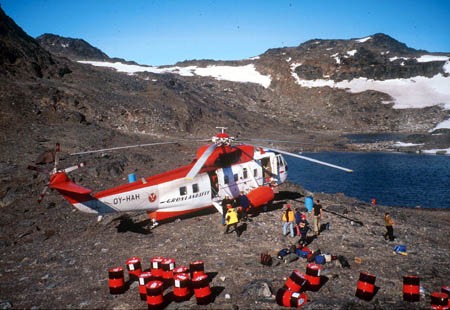
The Sikorsky cargo helicopter that flew us from Nuuk to the project base camp in the Isua complex. The project group consisted of a dozen geologists, who split into teams of two and three for intensive work in various areas of the complex.
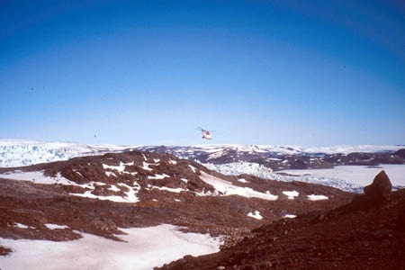
The Sikorsky leaving base camp, with a view of the Greenland ice cap to the upper left. Its a lonely feeling when the only way out leaves you behind!
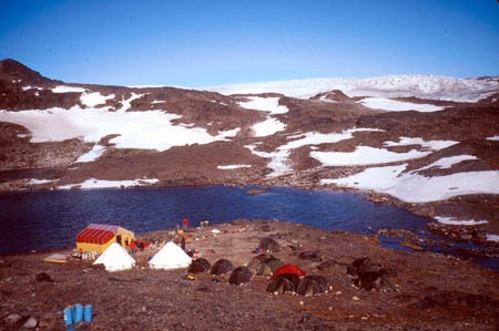
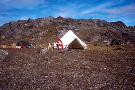
Our base camp set up, including the yellow and red communal tent for meals and workspace, two peaked supply tents, and the individual dome tents of the geologists and camp manager.
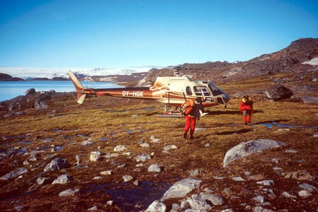
One of the smaller helicopters used for reconnaissance and setting up field camps. The pilot would drop us and our supplies for ten days, then departed to shuttle another team to their camp.
At each field camp we set up a work tent and our personal tents. The work tent had room for a mapping table and a small food-prep and eating table, plus our radio. We were expected to radio in to base every evening and report the locations of our planned traverses for the next day.
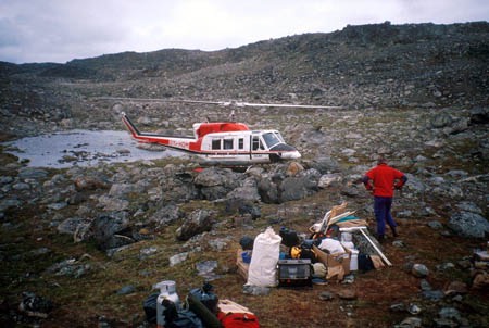
We knew from our daily radio contacts when to expect the helicopter. We planned for a certain number of days in each locality, but whether the helicopter could actually fly on any given day depended on visibility and wind, both of which are highly variable in such close proximity to the ice front.
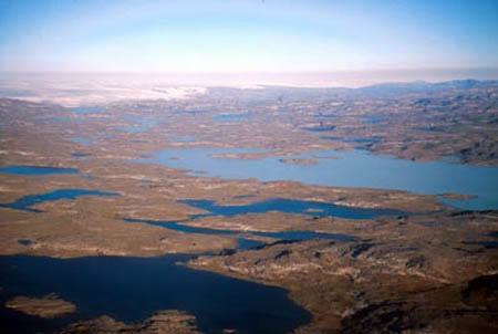
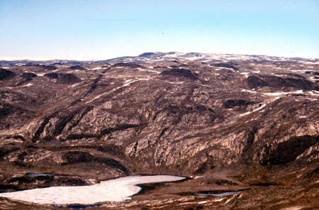
On a clear day from the helicopter, the bare glaciated terrain and many lakes and rivers can be clearly seen. White milky water in some of the lakes indicates that the lake receives drainage from the ice cap, seen in the background.
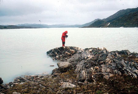
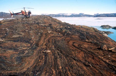
View Northeast up "Lake 644" on the west edge of the Isua Greenstone Belt. Felsic gneisses in the foreground form part of the footwall to the greenstone belt. The Ataneq Fault runs up the center of the lake. Formerly considered to be a major Neoarchean accretionary boundary between the Akia and Akulleq terranes, our work indicates that the two "terranes" were stitched at 2991 Ma and that this is not a fundamental tectonic boundary.
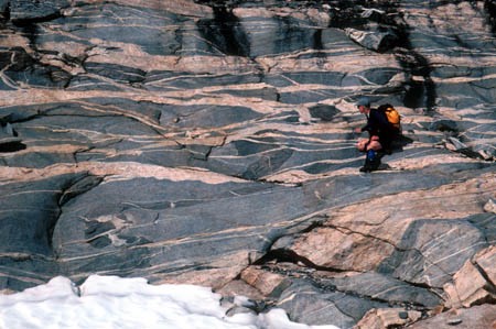
These finely banded and intensely folded calc-silicate rocks are exposed on a small island in "Lake 678", near the center of the Isua Belt. Formerly interpreted as having a sedimentary origin, these rocks are now thought to have formed by carbonate metasomatism of predominately basaltic protoliths.
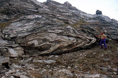
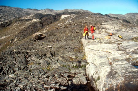
Simon Hanmer examining thrust-nappes in tonalite mylonite in the western footwall to the Isua Greenstone Belt.
Jim Crowley examining cross-cutting felsic dikes in the "Central gneisses", exposed in the horseshoe-shaped region between the northeast-trending arms of the Isua Greenstone Belt.
Undeformed mafic Tassartoq dikes (approx. 3.5 Ga) cutting the Central gneiss.
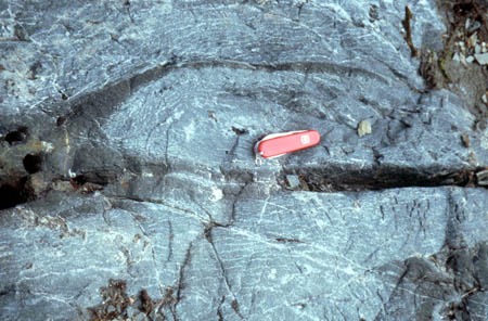
Flattened basalt pillow in the Isua Greenstone Belt between Lake 644 and Lake 678. Pillow basalts preserved in this area demonstrate the presence of significant bodies of water on the Earth's surface at 3.8 Ga.
Contact of Tassartoq dike with the central gneiss.
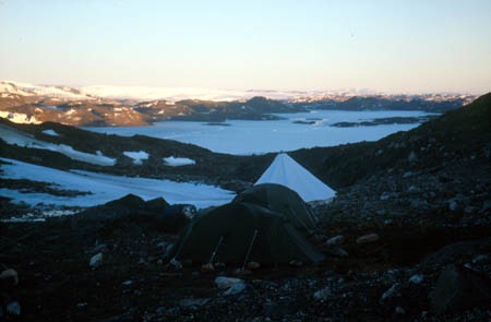
Sunset across the Greenland Ice Cap, from the Isukasia base camp at about midnight.